Our local Mountains where the Mountain Bike trails are planned to go are covered in archaeological heritage sites and features from the Wurundjeri peoples, from the early gold miners, timber cutters and tourists. Old Warburton was an gold-mining township and has the some of the earliest remains of home sites, a cemetery, school, police station, post office and hotel. The area is surrounded by mine sites, including hydraulic workings dating back to the 1860’s and mining activities in the area continued through to the Great Depression. The Timber Cutters left archaeological sites of mills and tramways over Mt. Tugwell, Mt. Little Joe and Mt. Donna Buang. Tourist operations have left archaeological sites of our early guest house history.
Biosis is the firm that has been engaged by the Yarra Ranges Council to do the Cultural Heritage Assessment for the Warburton Mountain Bike Destination.
This document is one of their assessments but is not the one they are currently working on for the project.
Biosis Cultural Heritage Assessment
Heritage Sites:
- Old Warburton Township Site
- Yarra Yarra Gold Sluicing Company Site
- Cement Creek Plantation (Redwood Forrest)
- Mount Donna Buang (Significant Landscape)
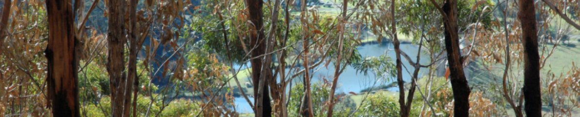
Old Warburton Township Site – Old Warburton Road
This site was, in the 1860s, a gold mining town. Originally called Yankee Jim’s, was established in 1863 and was the largest town on the Britannia Creek Goldfields. By the mid 1860’s it had a transitory population of gold miners and prospectors. Gold petered out in the late 1870’s and in the early 1880’s most of the population moved to the current township of Warburton. The original township was razed in the 1926 bushfires. The Old Warburton Township includes the Old Pioneer Cemetery (the oldest cemetery in the Shire of Yarra Ranges), the Police Barracks Site, School sites, Post Office Site, Edward Buller’s Hotel Site, the Yarra Yarra Gold Sluicing Company Works including the Water Race, the Shining Star Mine Site, the Lady Hopetoun Mine Site, Aboriginal Cultural Heritage Sites, Guest House Sites, early home sites, Unregistered Mine Sites.
The Warburton Mountain Bike Destination trails on Mount Tugwell are concentrated on the Township.
Yarra Yarra Gold Sluicing Company
A mountain bike trail has proposed to go right through the Yarra Yarra Gold Sluicing Company Site.
Updates :
July 2019: The new Masterplan shows the removal of the trail through the Heritage listed Yarra Yarra Gold Sluicing Company Site.
November 2018: Two residents have nominated this site for the Victorian Heritage Register and the nomination has been accepted. The area also has Aboriginal significance.
Victorian Heritage Database Report
Location:
390 Old Warburton Road,Warburton (Old Warburton)
Heritage Status / Level of Significance:
Included in Heritage Overlay
Heritage Inventory (HI) Number:
Listing Authority: HI
Heritage Overlay Number: HO342
Statement of Significance
The Yarra Yarra Gold Sluicing Company site has high local significance as an important gold mining site associated with Old Warburton’s years as a major Upper Yarra gold township. The site of the water wheel, along Yankee Jim’s Creek, which was used to drive the company’s battery, also has significance. These sites are two of a number of significant heritage sites associated with the heyday of Old Warburton township. They have historical significance for their associations with Gideon Scott Lang, holder of the mining lease in 1873, who was a Victorian pastoralist both in Victoria and New South Wales, author of important early studies of squatting and the aborigines in Australia, and “an adventurous and enterprising pioneer”, who was involved in the mining venture at Old Warburton during the last years of an eventful life. The company was suspended in 1884, three years after its founder’s death. The site has both historical and archaeological importance.
– Shire of Yarra Ranges Heritage Study 2000 by Context Pty. Ltd.
Description
The Yarra Yarra Hydraulic Gold Sluicing Company covers an extensive area that has now regenerated as bush. The company’s works involved extensive sluicing operations, creating a large, steep-sided “canyon” up to 10-12 metres deep. There are also some shafts and adits in this area, demonstrating a different form of gold-mining, and a water race.
Throughout the area there is evocative evidence of the operations, and of those who once lived and worked nearby. Some areas appear to have been used as camp sites associated with the works.
The whole site is quite fragile and needs to be protected from increased visitation. It is also likely to be at risk of looting.
Physical Conditions: Fair
Integrity: Intact
References:
– Shire of Yarra Ranges Heritage Study 2000 by Context Pty. Ltd.
Update: The Yarra Yarra Hydraulics Gold Sluicing Company Works has been nominated for the Heritage Register of Victoria.
Cement Creek Plantation – The Redwoods
The Redwoods stand in an area that is proposed for Stage 2 of the Warburton Mountain Bike Destination. Although this area has not been developed to Master Plan Stage, the Redwoods were proposed as a Trail Head (a car park for mountain bikers to park and bike), while a trail was proposed to go right through the Redwoods themselves in the Warubrton Mountain Bike Feasibility Study 2013. This document is 350 pages of detailed plans, maps and tables about the development of the Mountain Bike Destination and the use of the Redwoods is still on the table until it is officially withdrawn.
Victorian Heritage Database Report:
Location:
Warburton (near)
Heritage Status / Level of Significance:
Included in Heritage Overlay
Heritage Inventory (HI) Number:
Listing Authority: HI
Heritage Overlay Number: HO353
Statement of Significance
The Cement Creek plantation is of state significance due to its associations with the extensive revegetation program conducted by the MMBW in the 1920s and 1930s, following clearing of areas of the forested catchments through fires and logging. It demonstrates the scientific knowledge and availability of seed at that time, when the understanding of mountain ash regeneration was not well developed and the attitude towards revegetation with exotic tree species probably also reflected nineteenth century cultural attitudes towards aesthetic plantings. (McCann 1993: 127; Historic Places Branch)
The plantations of particular interest for its use as part of the Board’s forest hydrology research program, established in the 1940s and commenced at Coranderrk in the 1950s. The plantation represents the Board’s utilisation of conifer species already growing in the Cement Creek catchment, in order to acquire comparative data on canopy interception. (McCann 1993: 127)
References:
- http://vhd.heritage.vic.gov.au/yarraranges/result_details/115693
- Cement Creek Plantation_report_26-10-2018 (more details)
- National Trust Register of Significant Trees – Redwoods Cement Creek
- National Trust Register of Significant Trees – Pinus Muricata
- Yarra Ranges Heritage Study and Map – Cement Creek
- Trees Removed at Redwoods – Upper Yarra Mail
Parks Victoria has already cut down 34 of the trees (Pinus Muricata) that were on the National Trust List of Significant Trees:


Donna Buang Range
Location
WARBURTON, Yarra Ranges Shire
File Number
L10099
Level
Regional
Statement of Significance
The Donna Buang Range is of regional significance due to:- its outstanding visual importance as a component of the beautiful Upper Yarra Valley
- the magnificent panoramic views obtainable from many places within the Range
- its importance as habitat for native plant and animal species
- its role in the provision of nature-based recreational activities that are easily accessible to people of Melbourne
Location & Boundaries:
The Donna Buang Range is located approximately 40 miles east of Melbourne, generally between the townships of Healesville and Warburton. The Classified landscape is bounded in the north by the Coranderrk (Badgers) Creek and a line joining Mount Boobyalla, Boobyalla Saddle, the Knobs and Smiths Hill. To the south and west it abuts the Upper Yarra River Classified landscape and to the east the O’Shannassy Catchment Classified landscape.
Group
Landscape – Cultural
Category
Other – Landscape – Cultural

